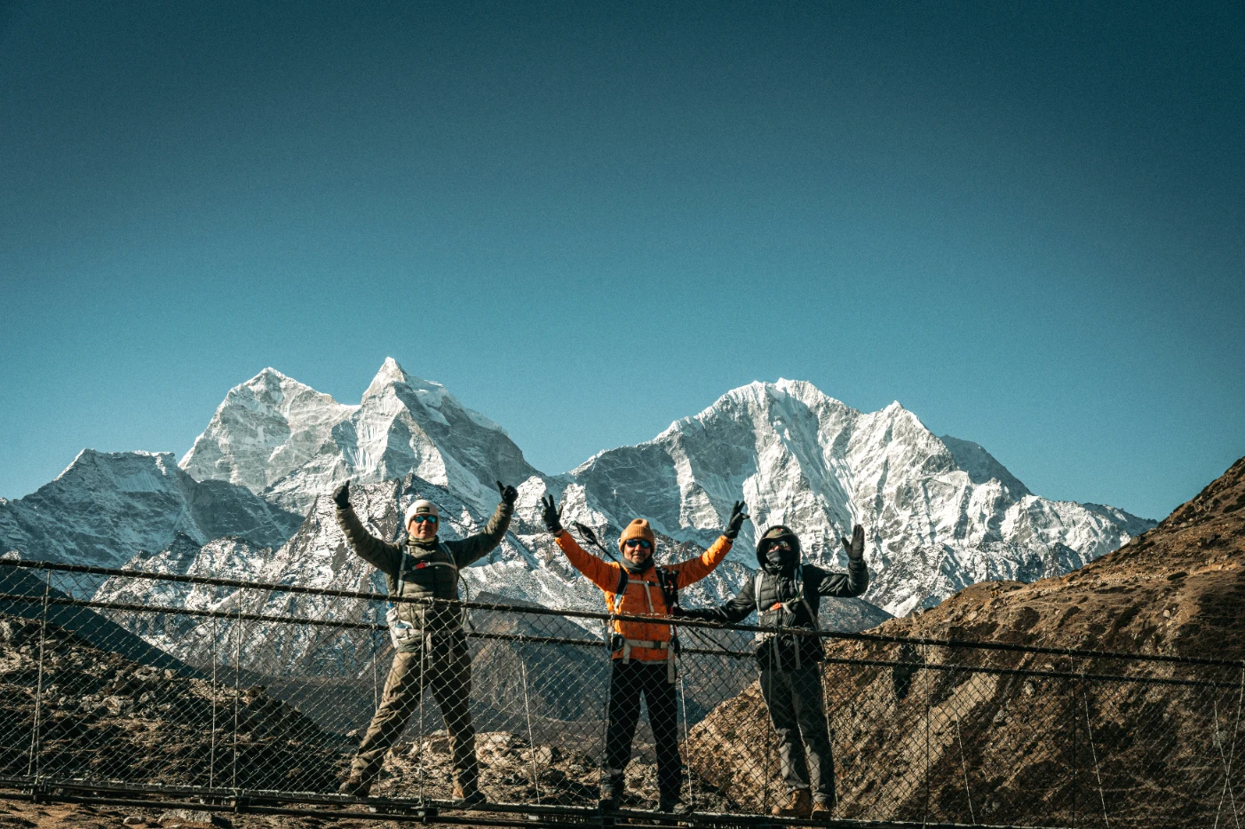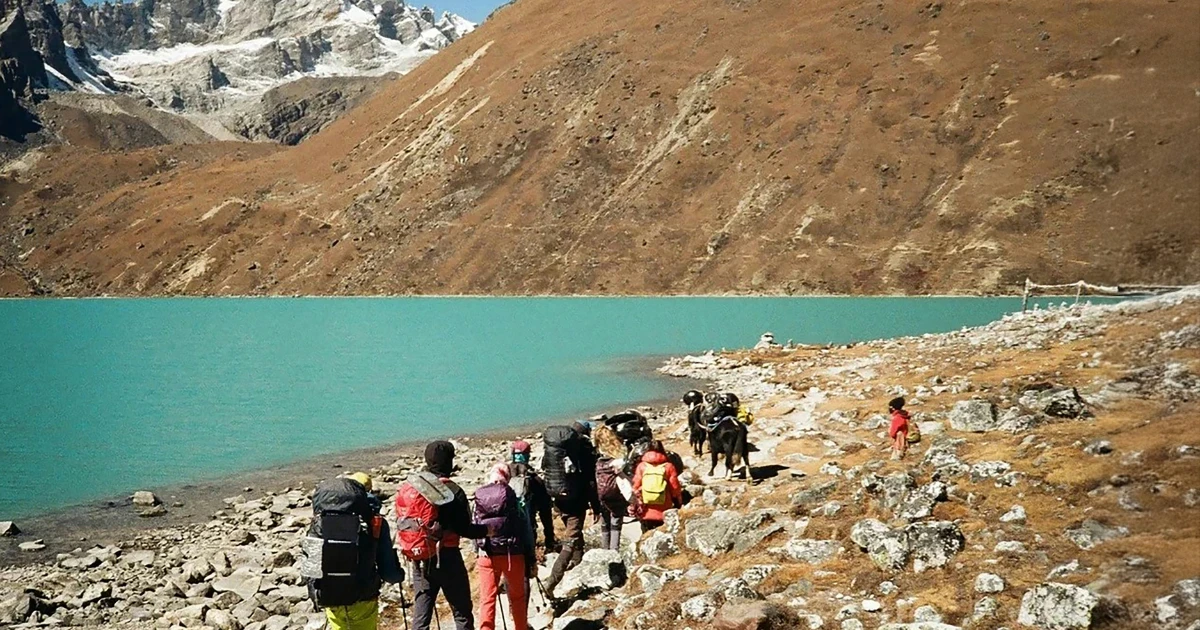
At Hiking Nepal, we get the same question from clients around day nine of this trek almost every season: standing in Manang at 3,519 metres, watching the Gangapurna glacier calve into its own lake below, they ask why nobody told them the Annapurna Circuit looked like this. The Everest Base Camp trail gets the postcards. The Annapurna Circuit, quietly, gets the range. Over three weeks or less depending on how we build your itinerary, you'll walk from subtropical rice terraces at under 1,000 metres to the roof of a 5,416 metre pass, through Gurung, Manangi, and Thakali villages that each feel like a different country, and back down into the arid, Tibetan-influenced landscape of Mustang on the other side. Few treks on earth change scenery, culture, and altitude this dramatically in a single continuous walk, and it's one we've been running long enough to know exactly where it still delivers and where it's changed.
This guide is our honest answer to what the Annapurna Circuit actually looks like in 2027, including the question we get asked most often now: how much of it is still a trek, and how much has become a road. We'll walk you through the route, the itinerary our guides actually recommend, what it costs with us, the permits you'll need, and the one section, Thorong La Pass, where a huge share of the trek's genuine risk is concentrated and where having the right guide matters most.
What the Annapurna Circuit actually is
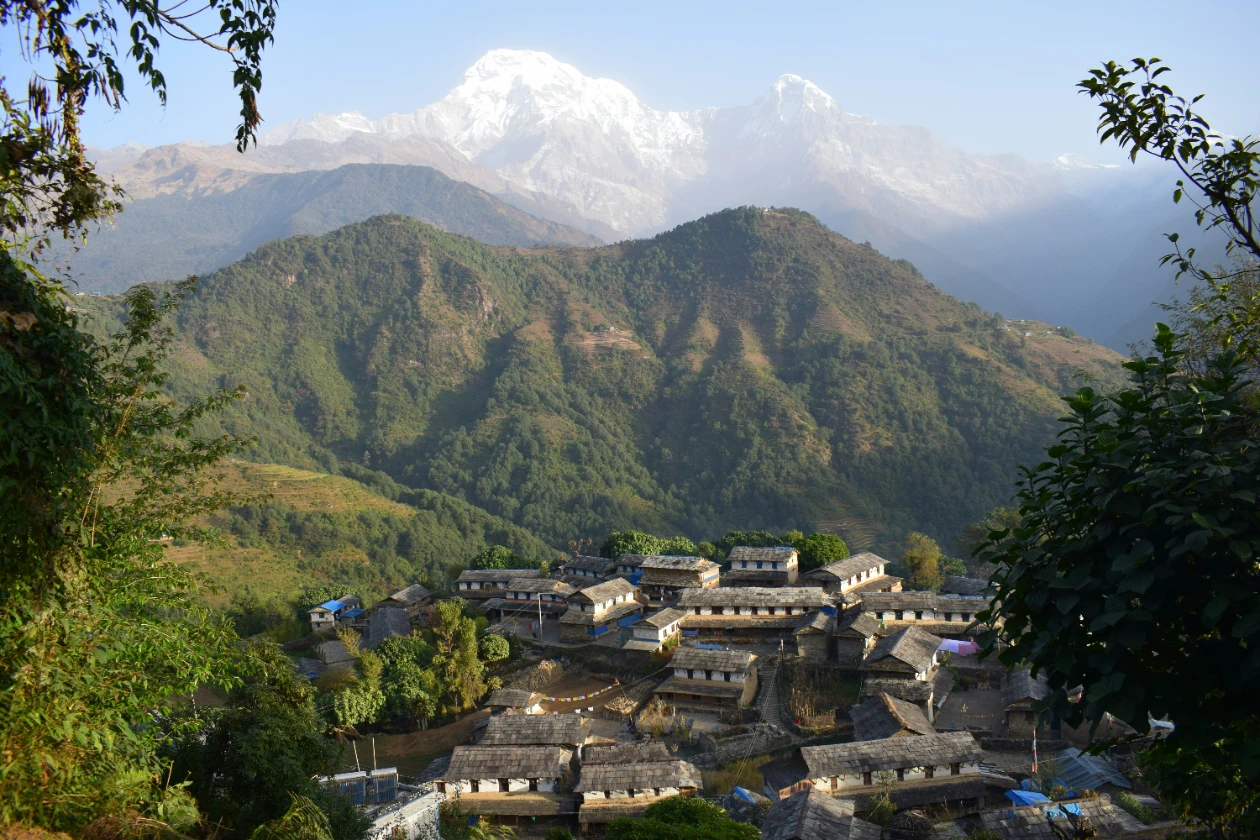
The Annapurna Circuit is a roughly 160 to 230 kilometre loop, depending on your exact start and end points and how many side trips you add, around the entire Annapurna massif. It begins in the lower, wetter Marsyangdi River valley near Besisahar or Chame, climbs steadily north through Manang, crosses the Annapurna range at Thorong La Pass, then descends into the dry Kali Gandaki valley through Muktinath and Jomsom before either flying out, driving out, or continuing on foot down toward Tatopani and Poon Hill for those wanting the full classic route. Unlike Everest Base Camp or Annapurna Base Camp, both of which are out-and-back trails to a single destination, the Circuit is genuinely circular, which is part of why the scenery changes so completely from one side of the range to the other.
The road question, and why it matters more than most guides admit
We need to address this honestly before anything else, because it's the single biggest change to this trek in the last fifteen years and a lot of older content online doesn't reflect it. Rural road construction has crept steadily up both sides of the Annapurna Circuit since the early 2010s, and by 2027, a jeep road now runs considerably further into the Marsyangdi valley than it did when this trek first became famous, in places running parallel to or directly over sections of the original trail.
What this means practically: the lower stretch of the classic route, roughly from Besisahar to Chame, has lost a meaningful amount of its trekking appeal to dust, jeep traffic, and construction noise in places, and most operators, us included, now start clients by jeep from Besisahar or even Dharapani or Koto, skipping the least rewarding road-affected days rather than walking them out of a sense of tradition. Above Chame, and particularly from Manang onward, the trail remains largely intact and is where the trek genuinely earns its reputation. We'll be upfront in the itinerary below about exactly where we'd recommend driving versus walking, because a client who's been told to expect a pristine wilderness trail the entire way and instead spends two days breathing jeep dust on a construction road is going to have a worse trip than one who knew what to expect and planned around it.
Difficulty rating
Moderate to challenging, and almost entirely because of two factors: the cumulative altitude gain over the trek's middle third, and Thorong La Pass itself. The daily walking is genuinely varied in gradient rather than uniformly steep, long, gently climbing valley days are mixed with a handful of properly demanding stretches, particularly the climb into Manang and the pass day itself. Most reasonably fit trekkers with some hiking background manage it comfortably provided the itinerary includes proper acclimatisation, which we'll come back to, since this is the one place where a rushed schedule causes real problems rather than just discomfort.
Full itinerary, day by day
We run this as an eighteen day itinerary from Kathmandu, which is on the fuller end of what's commercially offered but reflects what our guides consider the right amount of acclimatisation time rather than the bare minimum. Shorter fourteen to fifteen day versions exist and can work for very fit, previously acclimatised trekkers, though we'd want to have that conversation directly before recommending one.
Day 1: Arrive in Kathmandu, gear check and trek briefing.
Day 2: Drive from Kathmandu to Besisahar, then by jeep further up the valley to Chame, skipping the most road-affected lower stretch.
Day 3: Chame to Pisang, walking properly now, with your first real views of Annapurna II and Pisang Peak.
Day 4: Pisang to Manang, with an option to take the higher, quieter upper route through Ghyaru and Ngawal rather than the lower valley trail, both for the views and for the extra altitude exposure it builds ahead of the pass.
Day 5: Acclimatisation day in Manang, with a walk up to the Gangapurna Lake viewpoint or the Ice Lake trail above the village rather than a day spent resting indoors.
Day 6: Manang to Yak Kharka, a shorter day that starts the steady climb toward the pass.
Day 7: Yak Kharka to Thorong Phedi or High Camp, the last stop before the pass itself.
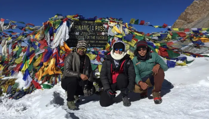
Day 8: Thorong La Pass crossing, Phedi or High Camp to Muktinath. This is the trek's defining day, and we've given it its own section below.
Day 9: Rest and explore Muktinath, its temple complex significant to both Hindu and Buddhist pilgrims, before continuing down into the Kali Gandaki valley.
Day 10: Muktinath to Jomsom, dropping fast in altitude through the increasingly dry, wind-scoured Mustang landscape.
Day 11: Jomsom to Kalopani or Tatopani, for clients continuing the full classic route rather than flying out from Jomsom.
Day 12: Tatopani to Ghorepani, climbing back up through forest, with the option of a natural hot spring soak in Tatopani beforehand.
Day 13: Ghorepani, early sunrise walk up to Poon Hill for the classic Annapurna panorama, then descend to Nayapul.
Day 14: Drive from Nayapul back to Pokhara.
Days 15 to 18: Buffer, Pokhara relaxation, and return to Kathmandu, with days built in specifically to absorb any Thorong La weather delays earlier in the trip.
Clients with less time commonly end the trek at Jomsom instead, flying out to Pokhara and skipping the Tatopani to Poon Hill extension, which shortens the trip by three to four days without missing the trek's genuine highlight.
Best season
Autumn, October to November, is the classic Annapurna Circuit window, with the clearest mountain visibility of the year and the most stable, predictable conditions on Thorong La specifically, which matters more here than on almost any other Nepal trek given how exposed and weather-dependent that single pass day is. Spring, March to April, runs a close second, adding rhododendron forest colour on the lower and middle sections in exchange for slightly less reliable long-distance visibility from afternoon haze. Winter, December to February, is possible but genuinely demanding, Thorong La frequently sees heavy snow that can close the pass entirely for days at a time, and we only run winter departures for well-prepared, flexible clients who understand the pass may simply not be crossable on their planned date. Monsoon, June to September, is avoided, the lower valleys become slippery and leech-heavy and visibility on the upper sections drops to near nothing.
Permits required
Two permits, both mandatory, and neither difficult to arrange. The Annapurna Conservation Area Project permit covers the entire route as it passes through the conservation area, and the Trekkers' Information Management System card, universally known as a TIMS card, is required for the trek generally. Both are typically arranged in Kathmandu or Pokhara before departure, either independently or through your operator, and we handle both for our clients as a standard part of booking. Unlike Everest's Sagarmatha National Park system, no separate rural municipality fee applies here, which keeps the Annapurna region's permit process a bit simpler overall.
Thorong La Pass: what actually happens on the trek's defining day
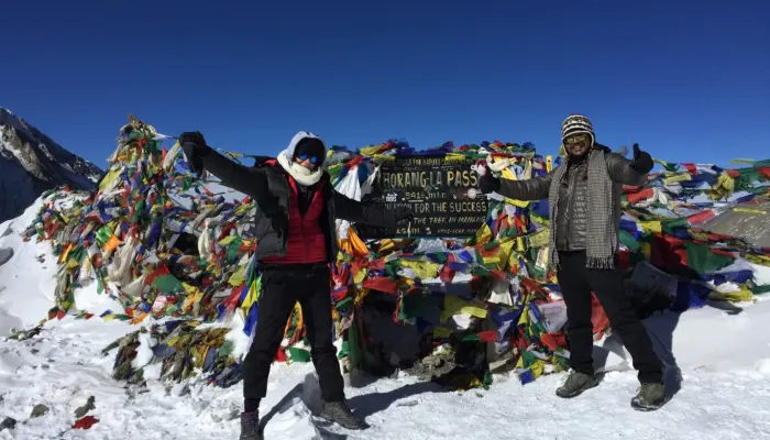
At 5,416 metres, Thorong La is the trek's high point in every sense, its most demanding day, its most photographed moment, and its greatest source of real risk. Most itineraries cross from Thorong Phedi, at around 4,540 metres, with an alpine start well before dawn, typically between 3 and 5am, both to catch stable morning conditions before afternoon winds pick up and to allow enough daylight for the long descent into Muktinath on the far side.
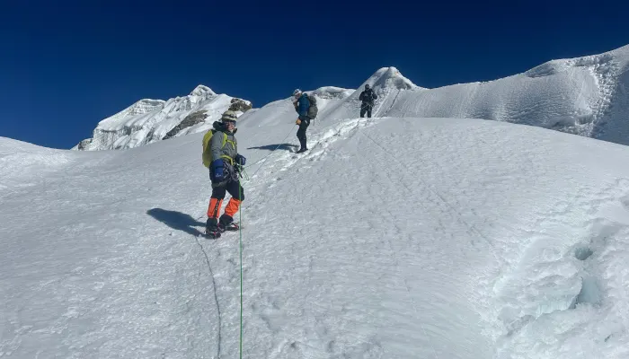
The climb itself isn't technical, no ropes or crampons, just a long, cold, high-altitude walk, but the combination of extreme early starts, biting wind, and the cumulative altitude of the days leading up to it makes this the single point in the trek where things most commonly go wrong. Weather can close the pass with little warning even in the reliable autumn season, and every year a handful of trekkers attempt it under-acclimatised or in worsening weather against their guide's advice, which is exactly the scenario proper guiding and a flexible itinerary exist to prevent. Our guides make the call on whether to cross, delay, or turn back on the morning itself based on conditions, and we ask every client to agree before departure that this call is final rather than open to negotiation on the mountain.
Altitude and acclimatisation
The Annapurna Circuit's altitude profile is genuinely different from Everest Base Camp's, and worth understanding on its own terms rather than assuming the two behave the same way. You'll spend several consecutive days above 3,500 metres in the lead-up to the pass, Manang at 3,519 metres, Yak Kharka at 4,018 metres, Thorong Phedi at 4,540 metres, before the pass itself at 5,416 metres, which is a longer sustained period at altitude than most EBC itineraries ask of you before their own high point.
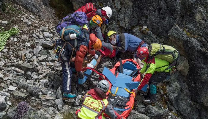
This is exactly why the Manang acclimatisation day isn't optional in any itinerary we'd put our name to. Acute Mountain Sickness, and its more serious forms, High Altitude Pulmonary Oedema and High Altitude Cerebral Oedema, are the trek's primary medical risk, considerably more common in practice than any injury from the walking itself. Know the early symptoms, headache, nausea, unusual fatigue, disturbed sleep, and treat a worsening symptom as a reason to stop ascending immediately, not something to push through because Thorong La is only a day or two away. The itinerary above builds in the gradual ascent profile that reduces this risk substantially, which is the honest reason it runs eighteen days rather than the twelve or thirteen some budget operators quote.
Teahouses and daily life on the trail
Teahouse lodging is available along the entire route, though standards vary meaningfully by section and season. Below Manang, teahouses are generally comfortable, with attached bathrooms increasingly common and reasonably reliable hot showers. Above Manang, toward Yak Kharka, Thorong Phedi, and High Camp, accommodation becomes noticeably more basic, thinner walls, shared or squat toilets, and hot water typically available only as a bucket service for a small extra charge. Wifi is widely available for a fee as far as Manang and becomes patchy or absent above that point, worth knowing if you're planning to stay reachable for work. Menus follow the standard Nepal teahouse pattern, dal bhat, noodle soups, momos, and simple Western options like pancakes and porridge, with prices climbing gradually the further from a road you get, unsurprising once you've watched a mule train or a porter carry the supplies in.
What it costs
Budget realistically for USD 1,500 to 2,500 per person for a fully guided and supported Annapurna Circuit trek of sixteen to eighteen days, covering ACAP and TIMS permits, a qualified guide, porter support, teahouse accommodation, and three meals a day on the trail. This sits below Everest Base Camp's typical cost range, mainly because there's no Lukla flight to factor in, and above a short trek like Poon Hill given the considerably longer duration.
What this generally doesn't include: personal gear, alcoholic drinks and bottled water on the trail, which get progressively more expensive the higher you climb, tips for your guide and porter, and rescue insurance. Independent trekkers without a guide can bring this down meaningfully, though we'd only recommend that route to genuinely experienced high-altitude trekkers given the pass-day decision-making a good guide provides.
Comparison table: Annapurna Circuit vs Annapurna Base Camp vs Everest Base Camp
| Features | Annapurna Circuit | Annapurna Base Camp | Everest Base Camp |
| Route type | Circular loop | Out and back | Out and back |
| Duration | 14-21 days | 7-15 days | 11-20 days |
| Max altitude | 5,416m (Thorong La) | 4,130m | 5,364m |
| Difficulty | Moderate-challenging | Moderate | Challenging |
| Permits | ACAP, TIMS | ACAP, TIMS | Sagarmatha National Park, Khumbu Rural Municipality |
| Flight required | No | No | Yes (Lukla) |
| Cost range | USD 1,000-1,800 | USD 700-1,300 | USD 1,300-2,200 |
| Best for | Trekkers wanting scenic and cultural variety over a longer trip | Trekkers with limited time wanting a genuine high-altitude experience | Trekkers prioritising Everest itself as the destination |
Annapurna Circuit versus Annapurna Base Camp
Since our Annapurna Base Camp guide has become one of our best-performing pages, this is a comparison we get asked about directly, often from clients who've already read that guide and are weighing the two against each other for the same trip window. Annapurna Base Camp is shorter, less committing, and doesn't cross anything close to Thorong La's altitude, making it the better choice for trekkers with a week to ten days rather than three weeks, or those wanting a strong high-altitude payoff without the sustained acclimatisation demands the Circuit requires. The Circuit, in exchange for the extra time and effort, delivers a completely different trek every few days, subtropical valley, high alpine desert, arid Mustang landscape, rather than the single ecological zone ABC largely stays within, along with considerably more cultural variety across Gurung, Manangi, and Thakali communities. Clients who've done ABC and want the same region's mountains from a genuinely different, more varied angle are exactly who the Circuit is built for.
Combining the Circuit with a side trip: Tilicho Lake and Nar Phu Valley
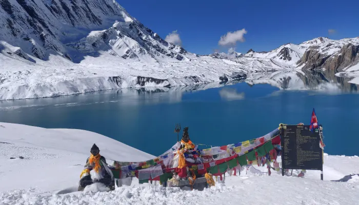
Two extensions come up often enough to be worth flagging directly. Tilicho Lake, at 4,919 metres, sits above Manang and is reachable as a three to four day side trip before rejoining the main Circuit route toward the pass, offering one of the highest lakes in the world and a genuinely different, starker landscape than the main trail. Nar Phu Valley, a restricted area requiring an additional permit and a minimum group size, branches off near Koto and leads into two remote, rarely visited villages that see a fraction of the Circuit's regular foot traffic, a strong option for clients who've done a busier trek before and specifically want solitude this time. Both add real time and cost to the standard itinerary, and we'd build either in as a deliberate extension discussed at the booking stage rather than a last-minute add-on
Safety considerations beyond altitude
Rescue insurance that specifically covers helicopter evacuation above 5,000 metres is essential given Thorong La's altitude, and we check this with every client individually rather than assuming a standard travel policy covers it, since a lot of policies cap coverage or exclude trekking above a certain height entirely. A qualified, experienced guide matters more on this trek than it might on a shorter or lower route, given both the pass-day decision-making involved and the genuinely variable weather Thorong La can produce with limited warning. Road traffic on the lower, jeep-accessible sections is worth a mention too, dust, noise, and the occasional need to step aside for a vehicle are now simply part of the early days of this trek in a way they weren't fifteen years ago, and we brief every client on this honestly rather than let them discover it as a surprise.
What to pack
Beyond standard trekking layers, expect a genuinely wide temperature range on this trek, from short-sleeve comfortable afternoons in the lower Marsyangdi valley to well below freezing on pass morning, so proper layering matters more here than on most Nepal treks. A good down jacket, a warm sleeping bag rated to at least minus fifteen, a headlamp for the pass day's pre-dawn start, sturdy broken-in trekking boots, sunglasses rated for high-altitude glare, and trekking poles, genuinely useful on the long, knee-testing descent from the pass into Muktinath, all belong on your list. Above Manang, pack a few extra layers you'd otherwise leave in your duffel, temperatures at Thorong Phedi and High Camp drop sharply once the sun goes down.
Frequently asked questions
How hard is the Annapurna Circuit Trek?
Moderate to challenging. The daily walking varies considerably in difficulty, but the cumulative altitude gain toward Thorong La Pass, and the pass day itself, are what genuinely test most trekkers rather than any single technical section.
How many days does the Annapurna Circuit take?
Fourteen to eighteen days is typical, depending on your starting point, whether you include the Tatopani to Poon Hill extension, and how much acclimatisation time your itinerary builds in.
What is the highest point on the Annapurna Circuit?
Thorong La Pass, at 5,416 metres, is the trek's highest and most demanding point.
Is the Annapurna Circuit still worth doing with the new roads?
Yes, particularly from Chame onward, where the trail remains largely intact and delivers the trek's genuine highlights. The lower Marsyangdi valley has lost some appeal to road construction, which is why most operators now start clients by jeep further up the valley rather than walking the full original route.
What permits do I need for the Annapurna Circuit?
An Annapurna Conservation Area Project permit and a TIMS card, both straightforward to arrange in Kathmandu or Pokhara or through your operator.
How much does the Annapurna Circuit cost?
A fully guided and supported trek typically runs USD 1,000 to 1,800 per person, depending on trip length, group size, and whether extensions like Tilicho Lake are included.
When is the best time to trek the Annapurna Circuit?
Autumn, October to November, offers the clearest visibility and most stable Thorong La conditions. Spring, March to April, is a strong second choice.
Is the Annapurna Circuit safer than Everest Base Camp?
Neither trek is inherently safer than the other. Annapurna Circuit's primary risk concentrates specifically around Thorong La's altitude and weather, while Everest Base Camp's risks are spread more evenly across a longer sustained high-altitude trek and the Lukla flight itself.
Can beginners do the Annapurna Circuit?
Yes, provided the itinerary includes proper acclimatisation and a guide experienced with pass-day decision-making. It's a more demanding undertaking than Annapurna Base Camp or Poon Hill, but genuinely achievable for a reasonably fit trekker with no prior high-altitude experience.
Should I add Tilicho Lake or Nar Phu Valley to my itinerary?
Both are worthwhile extensions for clients with the extra time and budget. Tilicho Lake suits anyone wanting a striking high-altitude side trip before the pass, while Nar Phu Valley suits clients specifically seeking a quieter, more remote experience.
Ready to walk the full range
The Annapurna Circuit rewards patience in a way few other treks do, three weeks that take you through nearly every landscape Nepal has to offer, ending on the far side of a mountain range most trekkers only ever see from one angle. We've built our itinerary around the acclimatisation days that actually matter, not the bare minimum a shorter package might offer, and our guides know exactly which lower sections are worth walking and which are better covered by jeep given how the roads have changed this trek over the past decade.
Hiking Nepal is a registered trekking operator based at Dabali Marga in Thamel, Kathmandu, with all the necessary affiliations and government registrations in place. Get in touch and we'll help you plan your Annapurna Circuit properly, with the right pacing before Thorong La, honest advice on whether Tilicho Lake or Nar Phu Valley is worth adding to your trip, and a guide who'll make the right call on pass day when it matters most. Message Nava directly on WhatsApp at +977 9802342080, or email us at [email protected], and we'll start building your itinerary.