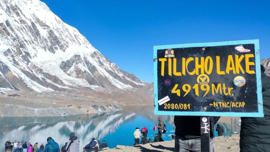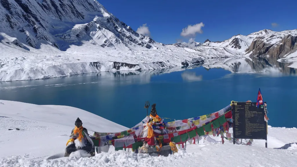
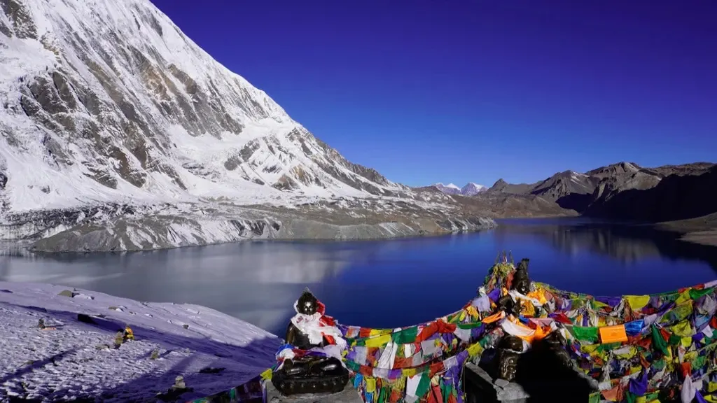
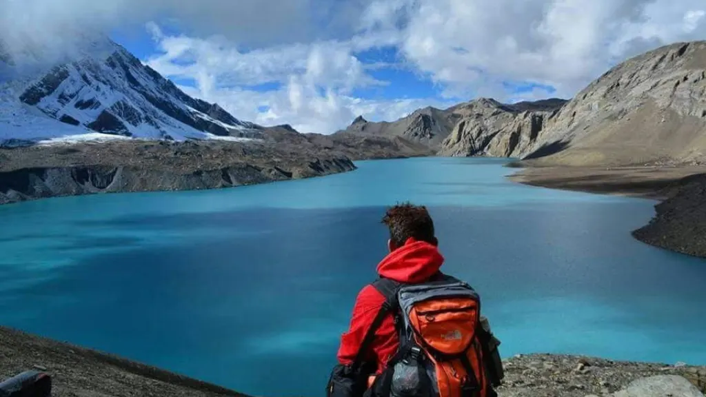
On day eight of walking to Tilicho, you leave the stone village of Khangsar at first light and walk toward a mountain wall that doesn't seem to have a way through it. The path narrows onto a moraine ridge with a drop on one side. Tilicho Peak (7,134 m) fills the sky ahead. Then, after hours of climbing, you crest a final rise and a lake appears at 4,919 metres, four kilometres long, its water turning from turquoise to silver as cloud moves over it. There's no teahouse crowd, no souvenir stall, just wind, rock, and a lake that most Annapurna Circuit trekkers never see.
Every season, a share of the trekkers who walk the Annapurna Circuit skip Tilicho. Others wonder whether the detour is worth three extra days at altitude. This guide answers that question from our side: how Hiking Nepal runs the Tilicho Lake and Annapurna Circuit Trek, what it costs, how hard it really is, and who should (and shouldn't) book it. If you're planning for 2027, everything below is built around our own 15-day itinerary.
Who this guide is for
Most of our clients on this route have already trekked at altitude somewhere, often Everest Base Camp or Annapurna Base Camp, and want a bigger, more varied walk. Some are first-time Nepal trekkers who are very fit and well prepared. If you're weighing Tilicho against a standard Annapurna Circuit, read the comparison and difficulty sections first.
What Tilicho Lake trek is
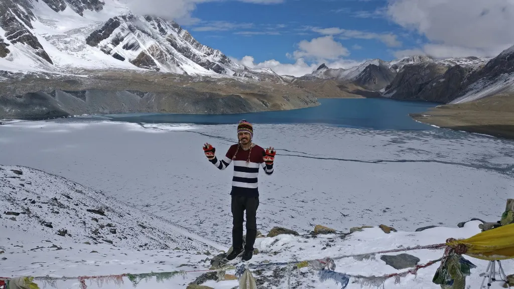
Tilicho Lake sits at 4,919 metres in the Annapurna Conservation Area, in Manang District. It's a glacial lake, fed by meltwater from the peaks around it, with Tilicho Peak and Nilgiri North rising above the basin. It measures roughly four kilometres in length and about 1.2 kilometres across, which makes it one of the largest lakes at this altitude that trekkers can reach on foot, without technical equipment.
You'll often read that Tilicho is the highest lake in the world. That claim is repeated widely in trekking literature, but it isn't quite accurate. Some sources cite Kajin Sara in the nearby Nar Phu region, at about 5,020 metres, as higher. A fairer description is that Tilicho is among the highest lakes in the world accessible to trekkers, and its size sets it apart.
The lake entered the wider mountaineering story in 1950, when the French Annapurna expedition led by Maurice Herzog passed through this area. Local communities in Manang had known it for centuries. It carries religious meaning for both Hindu and Buddhist traditions in the region.
Quick answer: how long, how hard, how much?
The Hiking Nepal Tilicho Lake and Annapurna Circuit Trek takes 15 days from Kathmandu, with around 10 days of actual walking. It's rated moderate to challenging, reaches a maximum altitude of 5,416 metres at Thorong La Pass, and costs from USD 1,590 per person for a solo traveller, with lower per-person rates for groups.
What is the Tilicho Lake trek? It's a side excursion from Manang on the Annapurna Circuit to a glacial lake at 4,919 metres. Our version combines it with the full Thorong La crossing and a flight from Jomsom to Pokhara.
Quick facts
Duration: 15 days
Walking days: about 10
Max altitude: 5,416 m (Thorong La Pass)
Tilicho Lake altitude: 4,919 m
Difficulty: Moderate to challenging (fitness level listed as moderate)
Best seasons: Spring, autumn (winter possible for experienced trekkers)
Group size: Minimum 2, maximum 10+, single travellers accepted
Meals: Breakfast, lunch, dinner
Accommodation: Hotel in Kathmandu and Pokhara, mountain lodges on the trail
Price: From USD 1,590 per person (1 person), USD 1,499 (2 to 7 people), USD 1,199 (8 or more)
Permits: ACAP and TIMS (included)
Route options and variations
Not every Tilicho itinerary is the same, and it helps to know where ours sits.
The first option is a Tilicho round trip from Manang: you walk to the lake and return the same way. It's shorter, but you miss Thorong La and Muktinath. The second is Tilicho via the Mesokanto La, which links the lake to Jomsom over a high, remote pass without crossing Thorong La. The third, and the one we run, is the full Annapurna Circuit with Tilicho as a side excursion. You cross Thorong La, descend to Muktinath and Jomsom, and fly to Pokhara.
Our itinerary makes Tilicho a proper highlight, not a detour squeezed in. It also helps with acclimatisation: the extra days between 3,700 and 4,900 metres leave you better adapted before the pass. If you'd prefer a version without Thorong La, speak to our team about what can be arranged.
Difficulty rating
We describe this trek as moderate to challenging. It isn't technical, so you won't need ropes, crampons, or mountaineering skills, and the daily walking averages five to seven hours. The challenge comes from sustained altitude and from two demanding days.
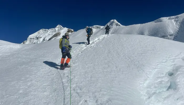
The first is the Tilicho Lake day. The path crosses a narrow moraine ridge that is landslide-prone in places. The gradient is steep, and even short climbs need careful pacing at this height. The second is Thorong La day: a pre-dawn start, a long climb to 5,416 metres, and a descent of around 1,600 metres to Muktinath, seven to eight hours in all.
Compared with Thorong La alone, adding Tilicho makes this the harder trek, mainly because of the exposure on the lake day and the extra time spent high. Compared with Everest Base Camp, it's comparable overall. EBC has more sustained days above 4,000 metres, while this route has one longer, colder pass day.
Full 15-day itinerary
Day 1: Arrive in Kathmandu (1,350 m). We meet you at the airport and take you to your hotel. Your guide briefs you on the route and checks your kit, followed by dinner.
Day 2: Drive to Besisahar (760 m), 6 to 7 hours. The road follows the Trishuli and then the Marsyangdi valley, past terraced fields and Gurung and Magar villages. Besisahar is the traditional start of the circuit.
Day 3: Drive to Chame (2,670 m), 7 to 8 hours. The road climbs through the Marsyangdi gorge into the Annapurna Conservation Area. You gain over 1,900 metres of sleeping altitude in a day, so drink water steadily and avoid alcohol tonight.
Day 4: Trek Chame to Pisang (3,200 m), 5 to 6 hours. You cross the Marsyangdi on suspension bridges, then Paungda Danda appears: a curved rock wall rising some 1,500 metres. The vegetation shifts from pine forest to dry, rain-shadow scrub.
Day 5: Trek Pisang to Manang (3,519 m), 5 to 6 hours. You can take the lower valley route or the high route through Ghyaru and Ngawal, longer but with the best Annapurna views on the circuit. Your guide will choose based on how you felt yesterday.
Day 6: Acclimatisation day in Manang. A walk toward Ice Lake (about 4,600 m) is the most effective option, or a gentler walk to the Gangapurna glacial lake. The Himalayan Rescue Association post gives altitude talks in the afternoon, and we encourage everyone to attend.
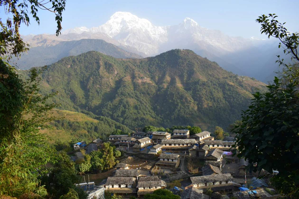
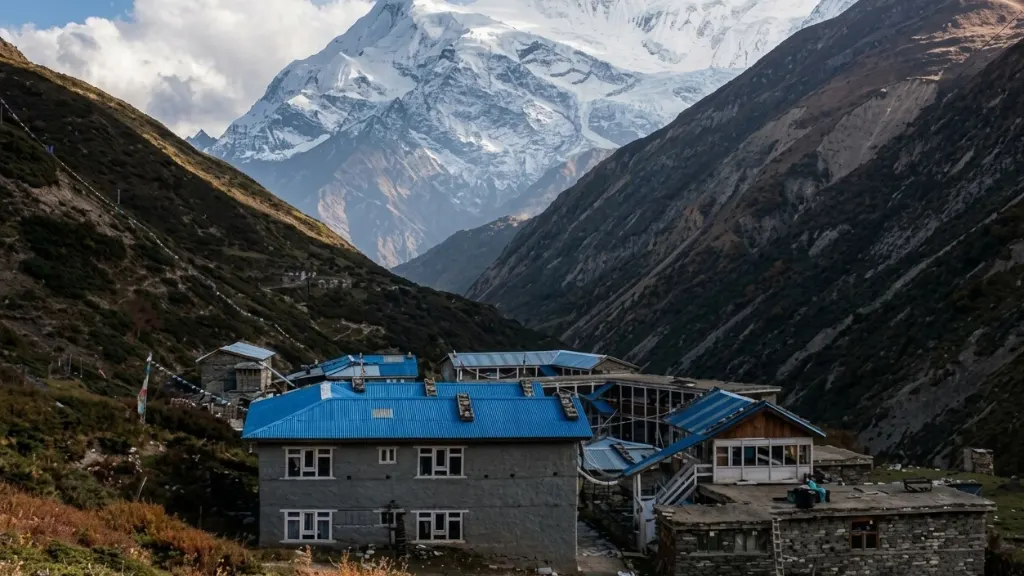
Day 7: Trek Manang to Khangsar (3,734 m), 2 to 3 hours. A short day on purpose. Khangsar is a quiet stone village, and Tilicho Peak first comes into view along the way.
Day 8: Tilicho Lake excursion (4,919 m). You leave at first light, cross the moraine ridge, pass Tilicho Base Camp (about 4,150 m), and climb to the lake. This is one of the longest days of the trip. Depending on pace and conditions, your guide will decide whether you return to Khangsar or spend the night at Tilicho Base Camp. Take your time at the lake.
Day 9: Trek to Yak Kharka (4,010 m), 4 to 5 hours. A recovery day with gentler gradients. Yaks graze around the settlement, and the night sky is superb.
Day 10: Trek to Thorong Phedi (4,450 m). A short walk to the foot of the pass. Some groups continue to High Camp (4,850 m) to shorten pass day. Pack your kit tonight, sleep early.
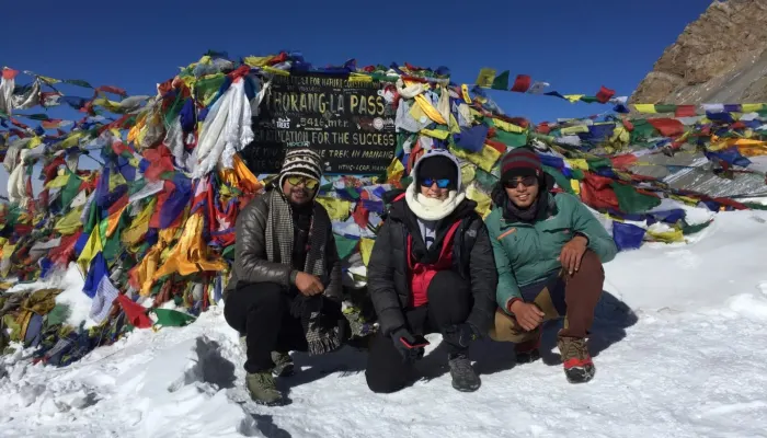
Day 11: Cross Thorong La (5,416 m) to Muktinath (3,800 m), 7 to 8 hours. You leave between 3 and 5 am. Reach the pass by 8 or 9 in the morning, before the wind builds, then descend to Muktinath.
Day 12: Trek Muktinath to Jomsom (2,720 m), 5 to 6 hours. You walk down the Kali Gandaki valley through Kagbeni. Afternoon winds can be strong, so we move steadily.
Day 13: Fly Jomsom to Pokhara (820 m), about 20 minutes. Jomsom flights run in the morning, before the wind rises. If one is cancelled, there's a road alternative via Beni.
Day 14: Drive Pokhara to Kathmandu. We run this by tourist bus, with a private vehicle or flight available. In the evening we host a farewell dinner in Thamel.
Day 15: Departure from Kathmandu.
Altitude and acclimatisation
The profile of this trek is built around sleeping altitude, not just maximum altitude. Here is where you spend each night.
Besisahar: 760 m
Chame: 2,670 m
Pisang: 3,200 m
Manang: 3,519 m (two nights)
Khangsar: 3,734 m
Yak Kharka: 4,010 m
Thorong Phedi: 4,450 m
Muktinath: 3,800 m
The Tilicho excursion helps in two ways. You touch 4,919 metres, then return lower to sleep, which follows the classic "climb high, sleep low" principle. And it extends your time above 3,500 metres before the pass, so your body has longer to adjust.
Altitude illness is the main medical risk on this route. Acute Mountain Sickness (AMS) starts with headache, nausea, poor sleep, and unusual fatigue. High Altitude Pulmonary Oedema (HAPE) and High Altitude Cerebral Oedema (HACE) are rarer but serious. If symptoms worsen, you stop ascending, and if they don't clear, you go down. Our guides make that call, and we ask every client to agree to it before departure.
One caution from our own itinerary: the drive from Besisahar to Chame gains over 1,900 metres of sleeping altitude in a single day. Some trekkers get a mild headache on arrival. Rest, drink water, and don't climb higher until it clears. A 12 or 13 day version of this trek exists elsewhere, and in our experience it cuts acclimatisation time, which is the wrong place to save days.
Best time to trek Tilicho Lake
Season / Months / What to expect
Spring / March to May / Warm days, rhododendrons at lower levels, calmer winds at Thorong La. Snow may linger in March.
Autumn / September to November / Clear skies, dry trails, best mountain views. Stronger winds at the pass, especially in October.
Winter / December to February / Cold, snow likely on the lake trail and pass. Risk of pass closure rises. Only for experienced trekkers with proper gear.
Monsoon / June to August / Heavy rain, leeches, washouts. Not recommended.
April, May, October, and the first half of November give the most reliable conditions for both the lake and the pass.
Permits
Two permits are needed: the Annapurna Conservation Area Project (ACAP) permit and the TIMS card. Both are included in your package, and we arrange them for you. Nepal's current rules also require foreign trekkers in conservation areas to be accompanied by a licensed guide, and your Hiking Nepal package includes one.
Cost: what you pay and what you get
Group size / Price per person
1 person: USD 1,590
2 to 7 people: USD 1,499
8 or more: USD 1,199
Included: airport transfers; farewell dinner in Thamel; Kathmandu to Besisahar and Besisahar to Chame transport (sharing vehicle, private upgrade available); 2 nights in a 3-star Kathmandu hotel with breakfast; 11 nights in mountain lodges; 1 night in a 3-star Pokhara hotel with breakfast; full board meals on the trek, including tea, coffee, seasonal fruit, and snacks; an English-speaking, first aid and eco-trained guide, an assistant guide depending on group size, and porters at a 2:1 ratio, with their insurance; the Jomsom to Pokhara flight and taxes; Pokhara to Kathmandu tourist bus; ACAP and TIMS; medical kit, duffel bag, trekking T-shirt, and adventure certificate; sleeping bag and down jacket on request; and all government and local taxes.
Not included: Nepal visa (USD 30 for 15 days, USD 50 for 30 days); lunch and dinner in Kathmandu and Pokhara except the welcome and farewell dinners; travel insurance; personal expenses such as drinks, extra snacks, laundry, and internet; emergency evacuation costs; and tips for guides, porters, and drivers.
Compared with a standard Annapurna Circuit, Tilicho adds extra days and extra logistics, which is reflected in the price. We suggest asking for both quotes side by side so you can see exactly what the lake costs you in time and money.
Teahouses and accommodation
On the trail you stay in mountain lodges, simple but comfortable below Manang, with a few attached bathrooms on some nights. Above Manang, expect thinner walls, shared toilets, and hot water by the bucket. Khangsar and Yak Kharka are small, so your guide books ahead. Menus are the usual Nepali teahouse staples: dal bhat, noodle soup, momo, porridge, and pancakes. Appetite often drops at altitude, so eat even when you're not hungry. Wifi works in Manang and gets patchy beyond it, so tell your family what to expect.
What to pack
You'll need a wide temperature range, from warm afternoons in the lower valley to well below freezing before dawn on Thorong La.
Clothing: two thermal base layers; fleece or light down mid layer; waterproof, windproof shell jacket and trousers; a warm down jacket; hat, balaclava or buff, liner gloves and outer mitts; sun hat and UV sunglasses.
Footwear: waterproof, broken-in boots with ankle support; camp shoes; four to five pairs of trekking socks; gaiters and microspikes for late autumn or winter.
Equipment: sleeping bag (we can provide one and a down jacket on request); trekking poles; headtorch with spare batteries; two-litre water capacity; water purification; sunscreen SPF 50; a small first aid kit; a 25 to 30 litre daypack.
Talk to your doctor about altitude medication, such as acetazolamide, before you travel. Carry enough prescription medicine for the whole trip.
Physical preparation
We suggest eight to twelve weeks of training. Walk regularly with a loaded pack, add stair climbing or hill work, and do cardio three or four times a week. If you can walk five to seven hours with a daypack and still feel good, you're close to the right level. Prior altitude experience above 3,500 metres makes acclimatisation easier, but strong preparation matters more than a long trekking record.
Safety considerations
Altitude first. Know the symptoms, tell your guide early, and accept the decision to stop or descend.
The Tilicho trail. The moraine section is exposed and landslide-prone in places. Stay on the marked path, don't rush, and follow your guide's instructions on loose ground. If conditions look wrong, your guide will turn the group around.
Thorong La. The early start is a safety measure, not a tradition. Wind through the pass builds from mid-morning and can drive wind chill far below freezing. If the pass is closed by snow or wind, your guide will decide between waiting at High Camp and returning to Manang.
Insurance. Your travel insurance must cover trekking above 5,000 metres and helicopter evacuation. Many standard policies cap cover at 4,000 or 4,500 metres or exclude trekking altogether. Check the wording, and tell your insurer the route reaches 5,416 metres.
Flights. Jomsom flights are cancelled more often than most mountain routes because of wind. We build in a road alternative and monitor flights for you.
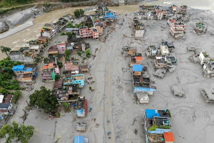
Is 2027 a good year to go? This route runs through the Marsyangdi and Kali Gandaki valleys, away from the Rasuwa, Nuwakot, and Dhading corridor affected by the August 2026 flash flood. As with any Nepal trek, check conditions with us before departure.
Tilicho lake trek compared with other Treks
| Trek | Duration | Max Altitude | Difficulty | Best For |
| Tilicho and Annapurna Circuit | 15 days | 5,416m | Moderate To Challenging | Trekkers wanting a lake plus the full pass |
| Staandard Annapurna Circuit | 12 To 14 days | 5,416m | Moderate To Challenging | Variety without the lake |
| Annapurna Base Camp | 7 To 11 days | 4,130m | Moderate | Shorter Trips,Lower Altitude |
| Everest Base Camp | 12 To 14 days | 5,364m | Challenging | Everest Views |
| Upper Mustang | 10 To 12 days | 3,840m | Moderate | Desert landscapes,flexible seasons |
Extensions and combinations
Many clients add a few days in Pokhara after the trek. If you want more, you can look at Nar Phu Valley before Manang, or Poon Hill after Jomsom. These add time and permits, so we'd plan them at booking rather than on the trail.
Who this trek is right for
It suits people who are physically active, comfortable walking five to seven hours, and happy to be cold and tired for a day or two in return for the scenery. Prior high-altitude experience helps. It's not recommended if you have serious heart or lung conditions, if you've had severe altitude sickness before, or if you've been inactive in recent months. If you're unsure, speak to your doctor and to us before booking. If you'd prefer something easier, Annapurna Base Camp or a shorter Annapurna Circuit may be a better fit.
What our guides wish trekkers knew
The lake day is the one people underestimate. They train for Thorong La and arrive at Khangsar relaxed, then find the moraine path and the length of the day more demanding than expected. Start early, leave the lake in good time, and keep something in reserve.
The rest day in Manang isn't a day off. Use it for a real acclimatisation walk and attend the altitude talk.
Keep your schedule flexible. Weather can move the pass day by a day, and the flight from Jomsom can slip. Don't book a tight international connection right after the trek.
Responsible travel
Tilicho matters to local communities, so treat the lake and the trail with respect. Take your rubbish with you, don't disturb prayer flags or mani walls, ask before photographing people, and spend your money in local teahouses and shops. At this altitude, small impacts last a long time.
Frequently asked questions
How hard is the Tilicho Lake trek?
Moderate to challenging. It isn't technical, but sustained altitude, a landslide-prone moraine section, and the Thorong La crossing make it demanding.
How many days does the Tilicho Lake trek take?
Our version takes 15 days from Kathmandu, with about 10 walking days.
How high is Tilicho Lake?
4,919 metres (16,138 feet).
Is Tilicho Lake the highest lake in the world?
It's often called that, but some sources cite Kajin Sara in Nar Phu at about 5,020 metres as higher. Tilicho is among the highest and largest lakes accessible to trekkers.
What is the best time to trek to Tilicho Lake?
April, May, October, and early November are the most reliable months.
How much does the trek cost?
From USD 1,590 per person for one traveller, USD 1,499 for groups of 2 to 7, and USD 1,199 for groups of 8 or more.
What permits do I need?
An ACAP permit and a TIMS card, both included in our package.
Is the Tilicho Lake trek dangerous?
The main risks are altitude illness, the exposed moraine section, and weather on Thorong La. A licensed guide, proper acclimatisation, and sound insurance reduce those risks substantially.
Can beginners do it?
Physically active beginners with good preparation can. It isn't a first trek for someone who doesn't exercise regularly. If you've never trekked at altitude, consider a shorter route first.
Do I need a guide?
Yes. Licensed guides are required for foreign trekkers in conservation areas, and every Hiking Nepal departure includes one.
Does this trek cross Thorong La?
Yes. After Tilicho, you rejoin the circuit and cross Thorong La (5,416 m) to Muktinath.
What happens if Thorong La is closed?
Your guide will decide whether to wait at High Camp or return to Manang. Closures are uncommon in the main seasons and most likely between late November and February.
Plan your Tilicho Lake trek with Hiking Nepal
If you're planning a 2027 trek and want to know whether Tilicho fits your dates, fitness, and budget, we'll give you an honest answer, including if a different route would suit you better. Hiking Nepal is a registered trekking operator based at Dabali Marga, Thamel, Kathmandu, with all the necessary affiliations and government registrations in place. Message Nava on WhatsApp at +977 9802342080, or email [email protected], and we'll start planning your itinerary.