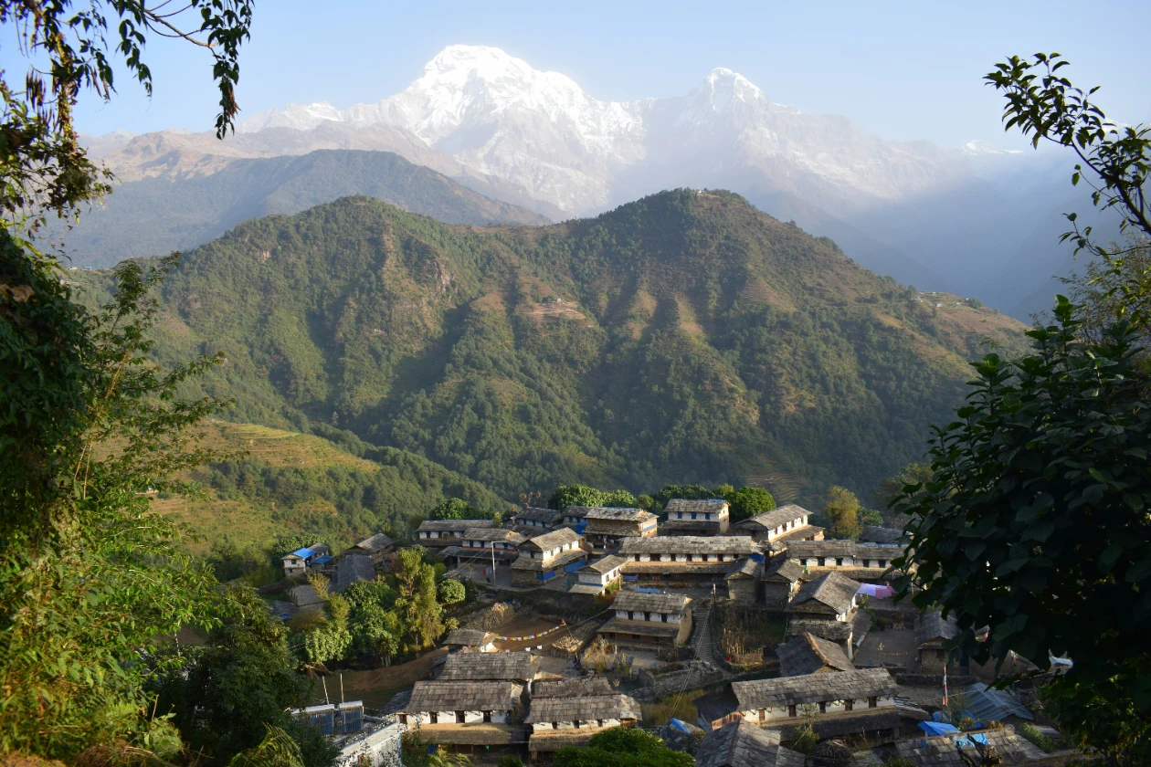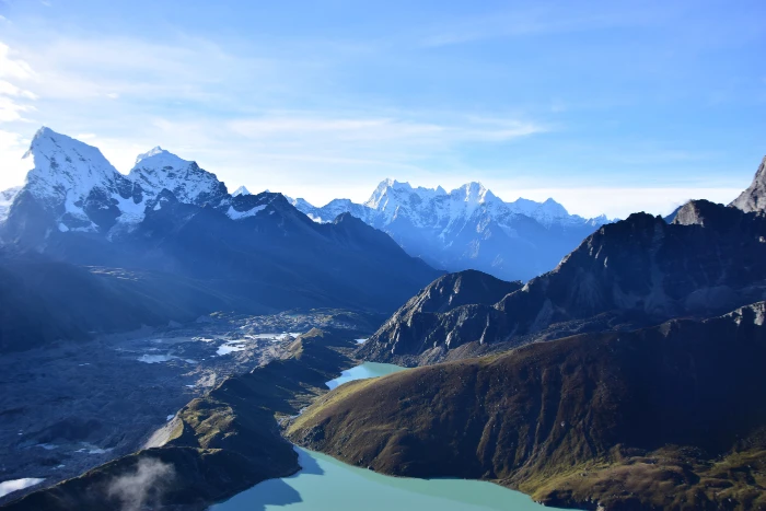
There is a moment on the summit of Gokyo Ri, at 5,357 metres, that most people who have done both the standard Everest Base Camp route and the Gokyo Valley describe in the same terms. The EBC view of Everest is dramatic and close but partial, foreshortened by the surrounding ridges, dominated by the Khumbu Icefall directly below. The Gokyo Ri view is different in kind. Standing on the summit at dawn with the Ngozumpa Glacier, Nepal's longest, spread across the valley floor below, and Everest, Lhotse, Makalu, and Cho Oyu all visible simultaneously in a single sweep, you understand why experienced Himalayan trekkers consistently rate Gokyo Ri as one of the finest viewpoints accessible without technical climbing equipment anywhere in the world.
The Gokyo Lakes trek reaches this summit through a route that is less crowded than the main EBC corridor, passes through terrain that includes some of the most striking glacial scenery in Nepal, and offers three to five turquoise high-altitude lakes at an elevation that makes their colour genuinely extraordinary rather than merely attractive. It is one of Nepal's finest trekking routes and one of its most underrated, consistently outperformed in booking volume by the EBC circuit despite offering a comparable or superior experience for most trekkers who have compared the two.
This guide covers everything you need to plan the Gokyo Lakes trek in 2027: the route and terrain, a day-by-day itinerary, the Gokyo Ri summit, the cost and permit structure, the best season, how it compares to the standard EBC route, and the practical details that determine whether a Khumbu trek succeeds or fails.
What Is the Gokyo Lakes Trek?
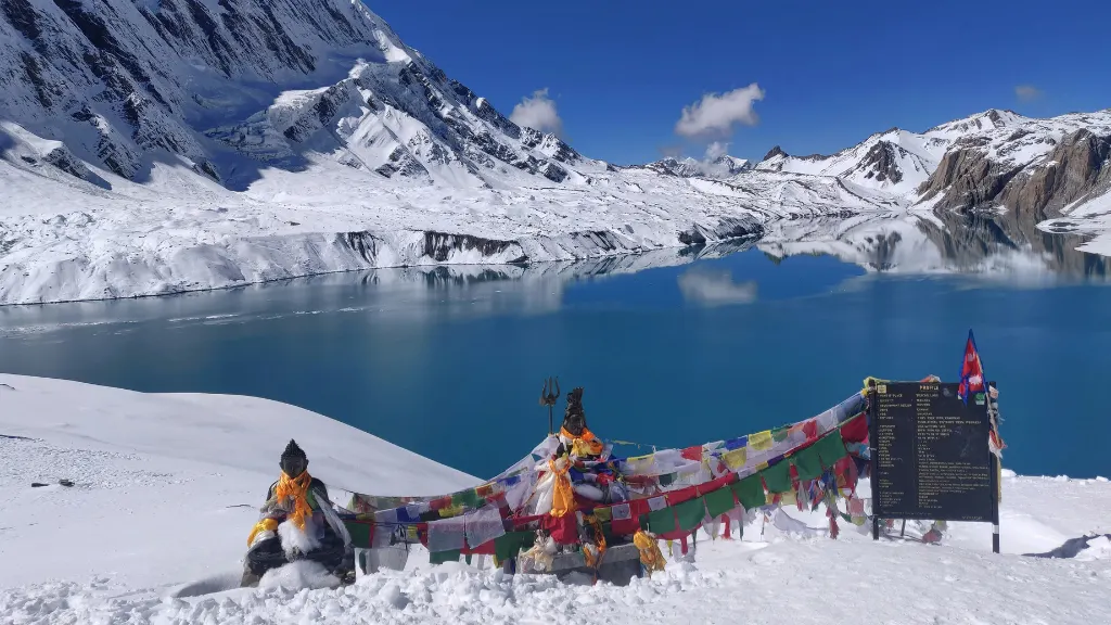
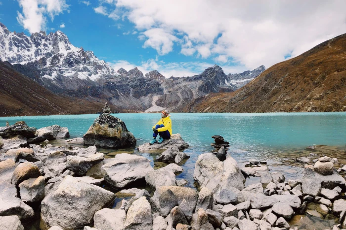
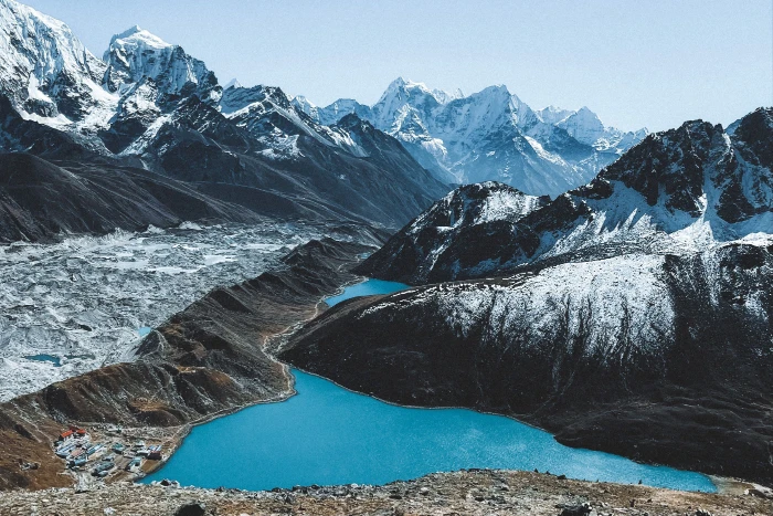
The Gokyo Lakes trek follows the Dudh Koshi river valley north from Lukla through the Khumbu region of northeastern Nepal, diverging from the main EBC trail at Namche Bazaar and heading northwest up the Gokyo Valley rather than northeast towards Tengboche and Lobuche. The route passes the Ngozumpa Glacier, Nepal's longest glacier at approximately thirty kilometres, and reaches the Gokyo Lakes, a chain of six glacially-fed lakes at altitudes between 4,700 and 5,000 metres whose turquoise colour results from the glacial mineral content of the water.
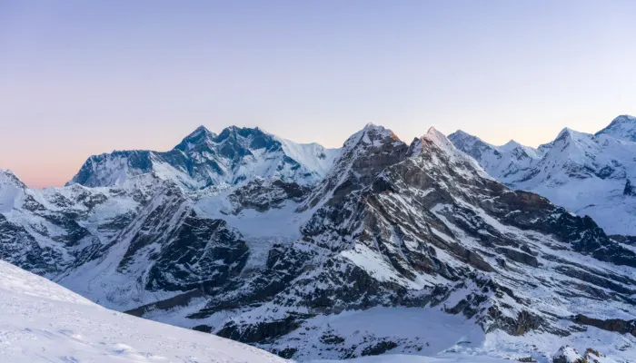
The main overnight destination is the village of Gokyo at 4,790 metres, the highest permanently inhabited settlement accessible on this route, from which the summit of Gokyo Ri at 5,357 metres is reached in a two to three-hour ascent. The panoramic view from Gokyo Ri takes in four of the world's fourteen peaks above 8,000 metres: Everest at 8,849 metres, Lhotse at 8,516 metres, Makalu at 8,481 metres, and Cho Oyu at 8,188 metres.
The standard itinerary runs twelve to fourteen days return from Lukla, making it comparable in duration to the standard EBC circuit. The trail shares the main EBC route as far as Namche Bazaar before diverging, which means the acclimatisation profile and the lower Khumbu cultural experience, including the Sherpa villages of Phakding and Namche, are common to both routes.
Why Choose Gokyo Lakes Over Everest Base Camp
This is the question most trekkers planning a Khumbu trip ask at some point, and it deserves a direct answer rather than a diplomatic comparison.
The Gokyo route is quieter. The main EBC corridor between Namche Bazaar and Lobuche carries the majority of the Khumbu's trekking volume, with the trail between Tengboche and Dingboche seeing consistent group traffic in both peak seasons. The Gokyo Valley receives substantially fewer trekkers, partly because it is less well-known internationally and partly because the combination of the lakes and the glacier creates a different kind of destination from the Base Camp achievement that drives EBC bookings. Trekkers who value the quality of wilderness experience over the recognition of the destination name consistently prefer Gokyo.
The views from Gokyo Ri are, for many trekkers, better than from Kalapatthar. This is subjective but defensible. Kalapatthar at 5,545 metres is 188 metres higher than Gokyo Ri, but it offers a close-range view of Everest's south face without the panoramic spread of multiple 8,000-metre peaks in a single frame. Gokyo Ri's lower summit gives Everest, Lhotse, Makalu, and Cho Oyu simultaneously, along with the extraordinary visual of the Ngozumpa Glacier below and the Gokyo Lakes reflecting the peaks in the valley. Many experienced Himalayan photographers specifically choose Gokyo Ri over Kalapatthar for this reason.
The lakes themselves are a destination with no equivalent on the EBC route. The combination of the glacial colour, the high altitude setting, the surrounding moraine, and the reflection of the peaks on still mornings creates the most photographically distinctive landscape accessible on any Khumbu trekking route. Trekkers planning the trip specifically for photography tend strongly towards Gokyo.
The altitude ceiling is marginally lower. Gokyo Ri at 5,357 metres versus Kalapatthar at 5,545 metres represents a meaningful difference in altitude demand for some trekkers, particularly those with a history of altitude sensitivity who still want a summit view in the Khumbu.
The argument for EBC over Gokyo is equally clear. EBC delivers the Everest Base Camp location itself, which carries a specific recognition and achievement quality that Gokyo does not replicate. Seeing the expedition tents in spring or the empty moraines in autumn at the foot of the Khumbu Icefall is a different kind of experience from the lakes. The Tengboche monastery and the villages of the main EBC corridor, including the teahouse culture of Namche and Dingboche, are more developed. For trekkers whose primary objective is standing at Everest Base Camp, EBC is the right route. For trekkers whose primary objective is the finest mountain panorama and the most visually distinctive landscape in the Khumbu, Gokyo is stronger.
The best answer for trekkers with sufficient time is the combined Three Passes and Gokyo circuit, which links both destinations across the Renjo La and Cho La passes and represents the most comprehensive Khumbu trekking experience available. This is covered at the end of the guide.
The Route and Terrain
The Gokyo Lakes trek uses the same Lukla approach as the EBC circuit and follows identical trail as far as Namche Bazaar before diverging. From Namche the route heads west and northwest up the Dudh Koshi and Gokyo Khola valleys, ascending steadily through a series of progressively higher and quieter teahouse stops before reaching the Gokyo Lakes basin.
The terrain changes significantly between the lower and upper sections. Below Namche the trail passes through subtropical and lower temperate forest alongside the Dudh Koshi river, crossing suspension bridges above the river gorge at regular intervals. Above Namche the vegetation transitions to high-altitude scrub and then to the open rocky terrain of the upper Khumbu, with the Ngozumpa Glacier moraine dominating the western side of the valley from Machhermo upwards.
The glacier itself is a defining visual element of the upper route. The Ngozumpa is heavily covered with rock debris from the surrounding moraines, giving it a greyish-brown rather than white appearance from a distance, and its scale only becomes apparent as the trail traverses alongside it. The active process of the glacier is visible in the ice formations, meltwater streams, and occasional calving events audible from the trail.
The Gokyo Lakes are reached in sequence as the trail climbs through the valley. The first lake, Longponga at 4,690 metres, appears approximately forty-five minutes above Gokyo village. The second, Taboche at 4,720 metres, is the largest. The third, Dudh Pokhari at 4,750 metres, is the most photographed and is the lake on whose shore the Gokyo village and teahouses sit. The fourth and fifth lakes, Thonak Cho at 4,830 metres and Ngozumpa Cho at 4,980 metres, are reached on an optional higher-valley day walk from Gokyo village. The sixth lake, Kyajo at approximately 5,000 metres, requires additional altitude gain and is reached by the most ambitious walkers on the rest day.
The Gokyo Ri summit at 5,357 metres is reached via a steep but non-technical ascent from the lake shore, gaining approximately 570 metres in two to three hours on a rocky path that requires good fitness and appropriate footwear but no technical equipment.
Day-by-Day Itinerary: Gokyo Lakes Trek 2027
The following is Hiking Nepal's recommended twelve-day itinerary for the Gokyo Lakes trek, designed with the correct acclimatisation profile and appropriate daily distances for the altitude demands of the route.
Day 1: Fly Kathmandu to Lukla (2,840m), Trek to Phakding (2,610m)
The day begins with the domestic flight to Lukla's Tenzing-Hillary Airport, a 35-minute journey that deposits you at 2,840 metres above the Dudh Koshi valley. The airport is the gateway to the entire Khumbu region, and the sense of arrival it produces, the small runway ending at a cliff edge, the mountains visible directly above the village, and the sudden quiet after Kathmandu's noise, is distinctive.
The walk from Lukla to Phakding descends gradually for approximately two hours to the river village of Phakding at 2,610 metres, passing through Chaurikharka and crossing the first of the suspension bridges that characterise the lower Khumbu trail. Starting slightly below the arrival altitude on Day 1 is a deliberate acclimatisation decision: the body begins adjusting at a lower sleeping altitude rather than at Lukla's already-moderate elevation.
Phakding's teahouses are the most accessible on the entire route and the least atmospheric, sitting at the junction of the main EBC and Gokyo trails before they converge for the Namche climb. An early dinner and a full night's sleep before the day's main ascent tomorrow.
Day 2: Phakding to Namche Bazaar (3,440m)
The day's objective is Namche Bazaar, the commercial and cultural capital of the Khumbu, reached after a route that crosses the Dudh Koshi on the famous Hillary Suspension Bridge at 3,440 metres and climbs steeply through the Sagarmatha National Park entrance. The first view of Everest appears briefly above the ridgeline on this ascent, a glimpse through the valley head that prepares the eye for the more extended views above.
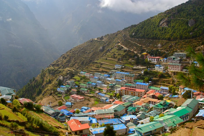
Namche Bazaar sits in a horseshoe-shaped bowl carved into the hillside, a town of stone and timber buildings housing everything from bakeries and cappuccino bars to trekking equipment shops and permit offices. The town is the social centre of the Khumbu trekking season and the acclimatisation base for every route into the high Khumbu. The climb from the river to Namche gains approximately 800 metres and is the steepest single ascent on the lower circuit.
Day 3: Namche Bazaar Acclimatisation Day
The acclimatisation protocol on the Gokyo route, as on the EBC route, requires two nights at Namche before ascending further. The day hike from Namche to the Everest View Hotel at 3,880 metres follows the ridge above the town and provides the first full panoramic view of the upper Khumbu peaks including Everest, Nuptse, Lhotse, Ama Dablam, and Thamserku. The return to Namche maintains the same sleeping altitude while the altitude gain of the day hike stimulates the acclimatisation process.
The afternoon in Namche is well-spent at the Sherpa Culture Museum, which covers the history of Sherpa mountaineering and the development of the Khumbu trekking industry in a thoughtful and well-curated collection, or at one of the town's bakeries, which operate at a standard that would be creditable in Kathmandu, let alone at 3,440 metres.
Day 4: Namche Bazaar to Dole (4,200m)
This is where the Gokyo route diverges definitively from the EBC trail. Rather than heading northeast towards Tengboche, the route turns northwest above Namche and climbs through the Khumjung and Khunde villages, the residential villages of most Namche Sherpa families, before descending to the river at Mong and ascending to the teahouse settlement of Dole at 4,200 metres.
The upper Khumjung valley has a different character from the main EBC corridor: quieter, with yak herding activity visible in the high pastures, and with views across to Khumbila, the sacred peak above Namche that is never climbed out of respect for the mountain deity. Dole is a collection of teahouses rather than a village, used primarily as a staging point for the Gokyo approach, and the accommodation is simpler than Namche or the main EBC stops.
Day 5: Dole to Machhermo (4,470m)
A moderate ascent day following the Dudh Koshi valley northwest through the abandoned summer pasture settlement of Lhabarma and on to Machhermo at 4,470 metres. The Ngozumpa Glacier becomes visible for the first time from the trail above Dole, a sprawling mass of rock-covered ice that fills the upper valley and gives the landscape a qualitatively different character from anything below.
Machhermo has a small Himalayan Rescue Association outpost staffed by medical volunteers during the trekking season, where trekkers can receive an altitude health briefing and assessment. Hiking Nepal guides conduct their own altitude checks at this stop and use the HRA staff as an additional resource when any member of the group is showing early signs of altitude sensitivity.
Day 6: Machhermo to Gokyo (4,790m)
The day's walk to Gokyo passes Pangka and then the first Gokyo lake at Longponga before reaching the lake shore village at 4,790 metres. The approach to Gokyo along the eastern shore of Dudh Pokhari, the third lake, with the turquoise water reflecting the surrounding peaks and the Ngozumpa Glacier visible across the valley, is the first moment of the trek where most trekkers stop walking without being prompted and simply look.
Gokyo village has a concentration of teahouses on the lake shore and a quality of landscape setting that rewards spending more time here than the minimum required for the Gokyo Ri summit. The village sits directly on the Dudh Pokhari shore with the glacier moraine rising steeply to the west and the Gokyo Ri ridge above to the east. On a clear evening, the peaks reflected in the lake as the light changes from afternoon gold to the blue of approaching dark are the defining visual memory of the route for many trekkers.
Day 7: Gokyo Acclimatisation Day, Optional Upper Lakes Walk
The rest day at Gokyo serves the dual purpose of acclimatisation and exploration of the upper lakes. The walk from Gokyo village to the fourth lake at Thonak Cho (4,830m) and the fifth lake at Ngozumpa Cho (4,980m) takes approximately three to four hours return and provides a close-range perspective on the glacier and the upper valley that the village viewpoint does not offer.
The fourth lake is the largest of the chain at approximately two kilometres in length, and its scale from the shore makes the surrounding peaks and glacier seem even more imposing than from below. The fifth lake sits in a more enclosed basin with the glacier directly adjacent, giving a visceral sense of the glacier's mass and movement that the more accessible lower lakes do not convey.
This day walk gains approximately 190 metres above the Gokyo sleeping altitude, which is within the recommended acclimatisation range and prepares the body for the Gokyo Ri summit the following morning.
Day 8: Gokyo Ri Summit (5,357m) and Descent to Dole
The Gokyo Ri ascent departs from the teahouse before dawn, typically between 5:00 and 5:30 am, to reach the summit for sunrise. The trail climbs steeply from the lake shore on a rocky path that requires good footwear grip and steady effort at altitude. The ascent gains approximately 570 metres in two to three hours.
The summit of Gokyo Ri at 5,357 metres is a broad rocky ridge with space for multiple groups and a series of prayer flag poles at the high point. The panorama from the summit covers Cho Oyu (8,188m) directly to the northwest, the Ngozumpa Glacier filling the valley below, the Gokyo Lakes visible as turquoise pools from above, Everest visible above the Lhotse-Nuptse ridge to the northeast, Lhotse (8,516m) and Makalu (8,481m) to the east, and the Kangchenjunga range visible on very clear days in the far east. The simultaneity of four 8,000-metre peaks in a single frame is the view's defining quality.
Descent from the summit returns to Gokyo for a late breakfast before the full descent to Dole at 4,200 metres in the afternoon. The descent retraces the morning's ascent and then continues down the valley. The legs are tired after the summit effort, and the Dole descent requires consistent attention on the rocky sections.
Day 9: Dole to Namche Bazaar (3,440m)
A long descent day that reverses the upper approach route back through Machhermo, Lhabarma, and the Khumjung ridge to Namche. The descent covers approximately 1,000 metres of altitude loss and takes five to six hours at a comfortable pace. The views of Ama Dablam, Thamserku, and Kantega from the ridge section above Namche on the descent are among the finest perspectives on these peaks available from any trail in the Khumbu.
Namche on the return feels considerably warmer and more comfortable than on the outbound leg, which is the standard experience at lower altitude after multiple days above 4,500 metres.
Day 10: Namche Bazaar to Phakding (2,610m)
The penultimate walking day descends from Namche through the Sagarmatha National Park to the river bridge and follows the Dudh Koshi valley back to Phakding. The trail is familiar from the outbound journey, and the lower altitude is increasingly warm and comfortable.
Day 11: Phakding to Lukla (2,840m)
The final walking day climbs from Phakding back to Lukla through Chaurikharka. The last few hundred metres of ascent to the Lukla airstrip is the reverse of the Day 1 descent and considerably less enjoyable after ten days of walking, but the teahouses in Lukla serve cold beer, freshly baked goods, and the warm atmosphere of trekkers in the final hours of a completed circuit.
The evening in Lukla includes the customary celebration dinner with the guide and porter team. Tips are given at this dinner. The Hiking Nepal emergency line is informed that the group is back at the Lukla departure point and the flight confirmation for the following morning is verified.
Day 12: Fly Lukla to Kathmandu
The return flight to Kathmandu completes the circuit. Weather permitting, the mountain views from the aircraft on departure from Lukla are the last Himalayan panorama of the trek and a fitting close to the route.
Gokyo Lakes Trek Cost 2027
The following breakdown covers a private guided Gokyo Lakes trek with Hiking Nepal over twelve days.
Cost Category | Amount (USD) | Notes |
| Sagarmatha National Park Permit | USD 30 | Per person |
| Khumbu Pasang Lhamu Municipality Permit | USD 23 | Per person |
| Lukla domestic flight return | USD 180 to 240 | Kathmandu to Lukla return, weather-dependent rebooking |
| Hiking Nepal package (guide, porter, accommodation, all meals, transfers) | From USD 1,450 per person | Private departure, 2 persons sharing |
| Equipment hire if needed | USD 80 to 120 | Sleeping bag, down jacket, trekking poles from Thamel |
| Travel insurance | USD 100 to 180 | Must cover helicopter evacuation and trekking above 5,000m |
| Tips for guide and porter | USD 120 to 200 | NPR 500 to 1,000 per day per person |
| Personal expenses | USD 80 to 140 | Hot showers, charging, Wi-Fi, snacks, cold drinks |
| Nepal visa | USD 50 | 30-day on arrival at Kathmandu airport |
| Total estimated per person | USD 2,113 to 2,533 | Private departure, spring or autumn season |
The Hiking Nepal private Gokyo Lakes package from USD 1,450 per person includes a licensed WAFA-certified guide, contracted porter at full IPPG welfare standards, all accommodation from Lukla to Lukla, all meals, all permit fees, private vehicle transfers in Kathmandu, altitude monitoring equipment, a full first-aid kit with altitude medications, and 24-hour emergency coordination throughout the trek.
Group joining departure prices for the Gokyo Lakes route start from USD 1,100 per person and include the same operational standard with a guide shared across four to six trekkers.
Permits for the Gokyo Lakes Trek in 2027
Sagarmatha National Park Permit
The Gokyo Valley falls within Sagarmatha National Park, one of Nepal's most significant protected areas and a UNESCO World Heritage Site. The park entry permit costs NPR 3,000 plus 13 per cent VAT per person, totalling approximately NPR 3,390 or USD 30. The permit is available at the Nepal Tourism Board office in Kathmandu or at the park checkpoint at Monjo, which is the first major checkpoint on the trail above Phakding.
The permit must be carried and presented at checkpoints throughout the route. Hiking Nepal processes all permit applications before departure and ensures every client carries the necessary documentation.
Khumbu Pasang Lhamu Rural Municipality Permit
This local government permit, introduced in 2021, is required for all trekkers entering the Khumbu valley and costs NPR 3,000 per person, approximately USD 23. It is collected at Lukla or at the checkpoint below Namche Bazaar depending on the point of entry. The permit revenue is directed to local infrastructure and community development projects in the Khumbu.
TIMS Card
No TIMS card is required for the Everest region. The combination of the national park permit and the municipality permit serves the same administrative function. This distinction from other Nepal trekking regions catches some trekkers by surprise: if you are told you need a TIMS card for the Gokyo route specifically, this is incorrect for 2027.
Best Season for the Gokyo Lakes Trek
Spring: March to May
Spring is the primary trekking and climbing season in the Khumbu and the most popular window for the Gokyo route. The weather stabilises after the winter cold from mid-March onwards, morning visibility at altitude is consistently good through April, and the rhododendron forests on the lower approach below Namche are in bloom in March and early April. The Gokyo Lakes in spring have their clearest colour as the winter ice has fully melted and the glacial meltwater is at its most mineral-rich and turquoise.
April is the busiest month of the spring season as it aligns with the main Everest expedition push and the associated trekking volume. The Gokyo route in April is significantly quieter than the main EBC corridor during the same period, which is one of the route's consistent advantages during peak season.
May offers warmer temperatures at lower altitudes but the pre-monsoon haze begins to build in the valleys from mid-May onwards, reducing visibility on the higher viewpoints. Early May departures up to approximately the 15th typically offer good summit visibility on Gokyo Ri. Departures in the second half of May risk hazy summit conditions.
Autumn: September to November
Post-monsoon autumn is the other main trekking season and offers the best overall clarity of the year. The monsoon washes the atmosphere clean through August, and the air from late September through mid-November is typically free of the particulate haze that affects spring visibility at lower altitudes. The Gokyo Lakes in October reflect the freshly snow-covered peaks in conditions that produce the most visually dramatic photography of the year.
October is the busiest month overall in the Khumbu, with both the EBC corridor and the Gokyo Valley seeing their highest annual trekking volumes in the first three weeks. The Gokyo route's lower crowd density relative to EBC is most pronounced in October, when the main corridor becomes genuinely congested. November is quieter with excellent visibility continuing through mid-month, but temperatures at Gokyo (4,790m) drop significantly in November nights and the approach to Gokyo Ri in late November requires full winter clothing layers.
Winter and Monsoon
December through February is cold and quiet. The Gokyo route is achievable in winter with appropriate equipment and experience, but night temperatures at Gokyo village can reach minus 20 degrees Celsius and some teahouses close during the low season. Hiking Nepal can arrange winter Gokyo departures for experienced trekkers specifically seeking the empty trail and crisp winter clarity, but these are not standard departures and require an additional planning conversation.
The monsoon from June through August brings persistent cloud and rain to the Khumbu at lower altitudes and makes the Gokyo Ri summit unreliable. The higher sections of the route are accessible in cloud-free windows during the monsoon but the overall experience is significantly compromised and the visual objectives of the trek, specifically the lake panoramas and the Gokyo Ri summit view, are weather-dependent in a way that makes the monsoon a genuinely poor season for this specific route.
Gokyo Lakes vs Everest Base Camp: Choosing Between Them
This is the most common planning question for trekkers who have decided on the Khumbu region and are deciding which specific route to take. The following comparison addresses the factors that matter most in this decision.
Factor | Gokyo Lakes Trek | Everest Base Camp Trek |
| Maximum altitude | 5,357m (Gokyo Ri) | 5,545m (Kalapatthar) |
| Summit view | Four 8,000m peaks simultaneously | Close-up Everest south face |
| Crowd level on trail | Moderate, lower than EBC | High in peak season |
| Lakes | Six glacial lakes, defining feature | None |
| Glacier access | Ngozumpa Glacier, Nepal's longest | Khumbu Glacier, accessible from Lobuche |
| Duration | 12 to 14 days | 12 to 14 days |
| Teahouse standard | Good, slightly less developed above Namche | Well-developed throughout |
| Cultural stops | Namche, Khumjung, Khunde | Namche, Tengboche, Pangboche |
| Photography | Lakes, glacier, four-peak panorama | Everest close-up, Ama Dablam |
| Cost | Comparable | Comparable |
| Achievement recognition | Less widely known | Globally recognised |
The honest summary is that Gokyo Lakes produces a more visually diverse and in most ways more beautiful trek experience. EBC produces the specific achievement of standing at Everest Base Camp, which carries a recognition and bucket-list quality that Gokyo does not replicate. Trekkers who are motivated primarily by the achievement should choose EBC. Trekkers who are motivated primarily by landscape, photography, and the quality of the mountain experience should seriously consider Gokyo.
The Combined Option: Gokyo and EBC via Cho La Pass
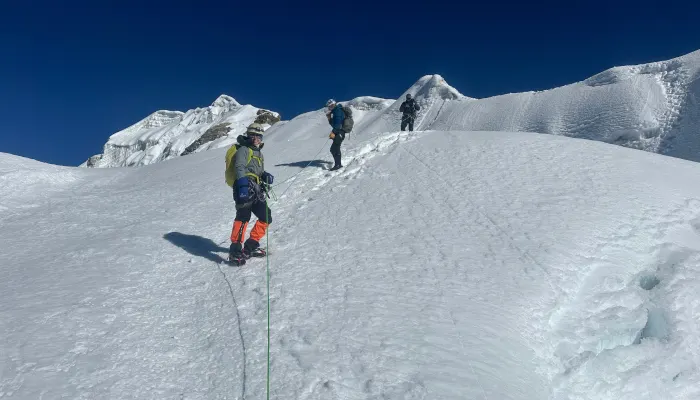
For trekkers with sixteen to eighteen days available, the combined circuit crossing the Cho La Pass at 5,420 metres connects the Gokyo Lakes route to the EBC trail, allowing both objectives within a single itinerary. The Cho La is a technical high-altitude pass that requires crampons and careful route-finding in icy conditions and should not be attempted without an experienced guide or in poor weather. When the conditions are right, it is one of the most dramatic single days available on any Nepal trekking route.
The combined circuit typically moves: Lukla, Namche, Gokyo (via the standard approach), Gokyo Ri, Cho La Pass crossing to Dzongla, Lobuche, EBC, Kalapatthar, Tengboche, Namche, Lukla. This direction, west to east across the pass, is the more commonly used and slightly easier approach in terms of gradient on the technical section.
Hiking Nepal runs combined Gokyo and EBC circuits as a standard itinerary option. The extended duration adds two to three days to the cost and requires an additional rest and acclimatisation day either at Gokyo or at Dzongla after the pass crossing to manage the cumulative altitude demands of the longer circuit.
For the full Three Passes circuit, which also crosses the Renjo La (5,360m) and the Kongma La (5,535m) in addition to the Cho La, see Hiking Nepal's dedicated Three Passes guide.
Accommodation and Food on the Gokyo Route
Teahouse Standards
The teahouse network on the Gokyo route is well-developed between Lukla and Namche, where the trail is shared with the main EBC corridor, and moderately developed from Namche to Gokyo. The teahouses at Dole, Machhermo, and Gokyo are smaller and simpler than the establishments at Namche or the main EBC stops at Tengboche and Dingboche, but they are clean, functional, and consistently heated.
Private rooms are available at all overnight stops on the standard itinerary. Attached bathrooms are available at Namche and at some Gokyo village teahouses but not consistently throughout the route. Hot showers are available at most stops up to Machhermo and on a solar-heated basis at Gokyo, costing NPR 300 to 500 per shower.
Hiking Nepal pre-books accommodation at inspected teahouses on all Gokyo departures. Peak season October bookings at Gokyo village in particular benefit significantly from pre-booking, as the limited teahouse capacity at 4,790 metres is fully occupied by the busiest weeks of the season.
Food
The teahouse menus on the Gokyo route follow the standard Khumbu pattern: dal bhat with unlimited refills at NPR 700 to 1,000 above Namche, noodle soup, fried rice, pasta, omelettes, porridge, chapati, and Western options at the larger teahouses near Namche. The food quality and menu variety narrows above Machhermo and at Gokyo the choice is more limited than at the main EBC corridor stops. Dal bhat is universally available and nutritionally complete. The unlimited refill convention at most teahouses makes it the best caloric value on the route.
Heating at Gokyo teahouses runs on yak dung in traditional stoves in the dining room. Bedrooms at 4,790 metres are cold regardless of the season. A sleeping bag rated to minus ten degrees Celsius is required for the Gokyo nights.
Health, Safety, and Altitude Management
The Gokyo Lakes trek reaches 5,357 metres on summit day and 4,790 metres for the multiple Gokyo overnight stays. The altitude demands are real and the acclimatisation profile in the recommended itinerary is specifically designed around the physiological requirements of spending three nights at and above 4,700 metres.
The acclimatisation days at Namche Bazaar (two nights) and the rest day at Gokyo before the summit are not optional enhancements. They are the physiological preparation on which the Gokyo Ri summit is safely possible for the majority of adequately acclimatised trekkers. Moving through this schedule faster, by skipping the Namche rest day or attempting Gokyo Ri on the first night at Gokyo, is the most common cause of altitude-related problems on this route and the most common reason for unsuccessful summit attempts.
The Himalayan Rescue Association maintains a health post at Machhermo during the main trekking seasons where trekkers can receive a formal altitude health briefing and check. Hiking Nepal guides conduct twice-daily oxygen saturation monitoring using calibrated pulse oximeters on all Gokyo departures, with the Machhermo stop providing an additional opportunity for assessment at a key acclimatisation milestone.
Emergency helicopter evacuation from the Gokyo Valley can be arranged from the flat area near the lake shore at Gokyo village in good weather. The flight to Kathmandu from this location takes approximately 45 minutes. All Hiking Nepal Gokyo departures carry supplemental oxygen, dexamethasone for HACE, nifedipine for HAPE, and a satellite communication device for emergency coordination outside mobile coverage areas above Namche.
Travel insurance for the Gokyo Lakes trek must cover trekking and helicopter evacuation to at least 6,000 metres. Verify the exact altitude coverage language in your policy before purchasing. Hiking Nepal verifies insurance documentation for all clients at the Kathmandu pre-trek briefing.
Practical Information
Getting to Lukla
The Tenzing-Hillary Airport at Lukla is accessed by domestic flight from Kathmandu. The flight takes 35 minutes on Buddha Air or Yeti Airlines and departs from Kathmandu's domestic terminal. The flight schedules are weather-dependent and delays of one to two days during peak season are possible, though the situation has improved significantly with the partial restoration of direct Kathmandu to Lukla flights that were previously routed through Ramechhap.
Hiking Nepal builds a weather contingency day into all Gokyo itineraries to absorb the most common flight delay without affecting the rest of the circuit. Clients who have fixed return international flights should allow an additional day of buffer beyond the planned trek completion date for this reason.
What to Pack
The Gokyo Lakes trek packing requirements are identical to the EBC route. Full cold-weather layering is required for the Gokyo overnight stays and the Gokyo Ri summit morning. The summit departure in late October can see temperatures at the starting point of minus 10 degrees Celsius or lower. A down jacket rated to minus fifteen degrees Celsius minimum, thermal base layers, windproof outer layers, warm gloves, and a warm hat are required rather than optional.
Trekking poles are strongly recommended for the Gokyo Ri ascent and descent, where the rocky terrain and altitude-affected fatigue make ankle stability on the descent a practical concern.
A reusable water bottle and purification tablets or a filter reduce both plastic waste and cost on the trail. Bottled water above Namche costs NPR 150 to 300 per litre, and the cost adds up significantly over twelve days. Filtered water from teahouse stations at NPR 50 to 100 per litre, or purified water from the guide's kit, is the recommended alternative.
Currency and Connectivity
ATMs are available at Namche Bazaar and nowhere else on the Gokyo route. Withdraw sufficient cash in Kathmandu before departure and maintain a supply in Namche if needed. NPR 30,000 to 50,000 covers personal expenses for the full circuit at most spending levels.
Mobile data coverage (NTC and Ncell) extends to Namche reliably and to Machhermo intermittently. Above Machhermo, coverage is unreliable. Wi-Fi is available at teahouses at Namche, Dole, and Gokyo village at NPR 300 to 500 per hour on satellite systems. Reliability varies. A power bank with 20,000 mAh capacity covers the days without reliable teahouse charging.
Frequently Asked Questions
Is the Gokyo Lakes trek harder than Everest Base Camp?
They are broadly comparable in difficulty. The Gokyo route's maximum altitude at Gokyo Ri (5,357m) is slightly lower than Kalapatthar on the EBC route (5,545m), but the Gokyo Ri summit involves a steeper and more sustained ascent from the lake shore than the Kalapatthar climb from Gorak Shep. The acclimatisation profile, daily distances, and overall physical demands are comparable between the two standard itineraries.
Can I do the Gokyo Lakes trek without a guide?
Nepal's 2026 No Solo Trekking regulation requires foreign nationals to trek with a licensed guide in national parks and conservation areas. The Gokyo route falls within Sagarmatha National Park and is subject to this requirement. Practically, the benefits of a licensed guide on the Gokyo route, including altitude monitoring, teahouse pre-booking, permit management, and emergency response capability, are significant enough to make the guide valuable entirely independent of the regulatory requirement.
How many people trek the Gokyo route compared to EBC?
Reliable comparative figures are not publicly available from the Nepal Mountaineering Association or Nepal Tourism Board, but experienced Khumbu guides consistently estimate that the Gokyo Valley receives approximately fifteen to twenty-five per cent of the trekker volume of the main EBC corridor. The difference is particularly pronounced at and above Machhermo, where the trail diverges most strongly from the EBC route.
Is Gokyo Ri harder than Kalapatthar?
Gokyo Ri involves a steeper and longer ascent (570 metres, two to three hours) from a higher starting point (4,790m at Gokyo village) than the Kalapatthar approach (approximately 400 metres, one to two hours from Gorak Shep at 5,140m). Most trekkers find the Gokyo Ri ascent more physically demanding while acknowledging that the summit view rewards the additional effort.
What is the best month for the Gokyo Lakes in 2027?
Late March to mid-April for the spring season, giving the best combination of clear lake colour, rhododendron bloom on the lower approach, and good summit visibility before pre-monsoon haze builds. Mid-October for autumn, offering the best post-monsoon clarity and the most striking reflection conditions on the lakes.
Can the Gokyo Lakes trek be done in fewer than twelve days?
A ten-day version is possible by combining some of the approach days and moving faster on the descent. Hiking Nepal does not recommend the ten-day version for first-time high-altitude trekkers because it compresses the acclimatisation schedule and reduces the margin for weather delays and health adjustments. For trekkers with prior Khumbu experience and established altitude tolerance, the ten-day option is worth discussing at the consultation stage.
What is the Gokyo Ri view actually like compared to written descriptions?
This is the question that the photographs and written accounts struggle to answer accurately, because the quality of the Gokyo Ri panorama is not primarily a matter of which peaks are visible, it is a matter of the spatial relationship between them and the observer. At 5,357 metres, surrounded by 6,000 to 8,000 metre peaks in every direction, with the largest glacier in Nepal below and the turquoise lakes visible as colour in the valley floor, the sense of being inside the Himalaya rather than viewing it from outside is unlike anything available at lower elevations. The written description approximates this. The experience itself does not require approximation.
Book Your Gokyo Lakes Trek with Hiking Nepal
Hiking Nepal runs private guided and small group joining departures on the Gokyo Lakes route throughout the spring and autumn seasons of 2027. Spring 2027 departures run from mid-March through early May. Autumn 2027 departures run from late September through mid-November. The mid-October window fills earliest for both private and group joining options.
Every Hiking Nepal Gokyo departure includes a licensed WAFA-certified guide, contracted porter at full IPPG welfare standards, all accommodation at pre-selected and pre-booked teahouses from Lukla to Lukla, all meals, all permit fees, private vehicle transfers in Kathmandu, altitude monitoring, a full first-aid kit with altitude medications, supplemental oxygen, and 24-hour emergency coordination throughout the trek.
Contact Hiking Nepal on WhatsApp at +977 9802342080 or at [email protected] to discuss your preferred dates, group size, and fitness level. A full itinerary and cost proposal are provided within 48 hours of your initial enquiry.
The Gokyo Lakes are waiting. The four peaks are visible from the summit on a clear morning. The only decision is when you want to be there.